Hyperlocal data in the Map Room – looking for Nonprofits near me

We get a lot of data questions at SparkMap, but one of the more frequent ones is: How can I get hyperlocal data to understand the assets within my community?
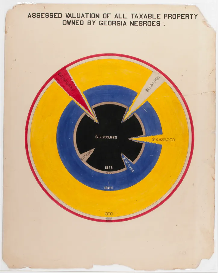
In this blog, let’s explore that question with a timely example. According to the National Association of Nonprofit Organizations & Executives (NANOE), the largest monthly percentage of annual donations to nonprofits occurs in December. In the spirit of this giving season, let’s explore how we can use SparkMap to find local nonprofits that we may want to donate to this year.
In this blog, we’ll:
- Create a map with a layer and zoom to a location
- Use the Select Data tool to see these data in context of a specific region or distance from a point
Nonprofit Backstory
We often hear the terms “nonprofit”, “501(c3)”, and “501(c4)”, but what makes them so special and why do people give them money?
In short, nonprofits are legal entities operating for a collective, social, or public benefit. And, whether (c)(3), (c)(4), or (c)(something else), they are allowed to make a profit in spite of their “nonprofit” status. However, they’re not allowed to give that extra cash to any individuals, or shareholders, or boards – they usually reinvest that extra money into their staff and mission. This is a big reason that so many people donate to these organizations – it feels good to support a cause you believe in and know that your money is going 100% towards that cause.
Find those Nonprofits!
Set up the Map
First, let’s go to the Map Room. The “Search Data” window will appear with a prompt to enter a search term. Let’s search for “nonprofit”.
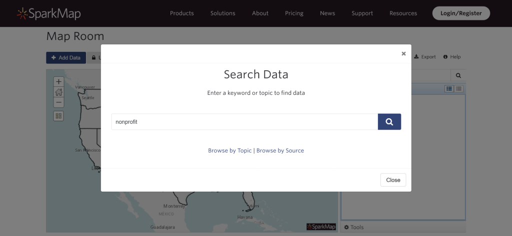
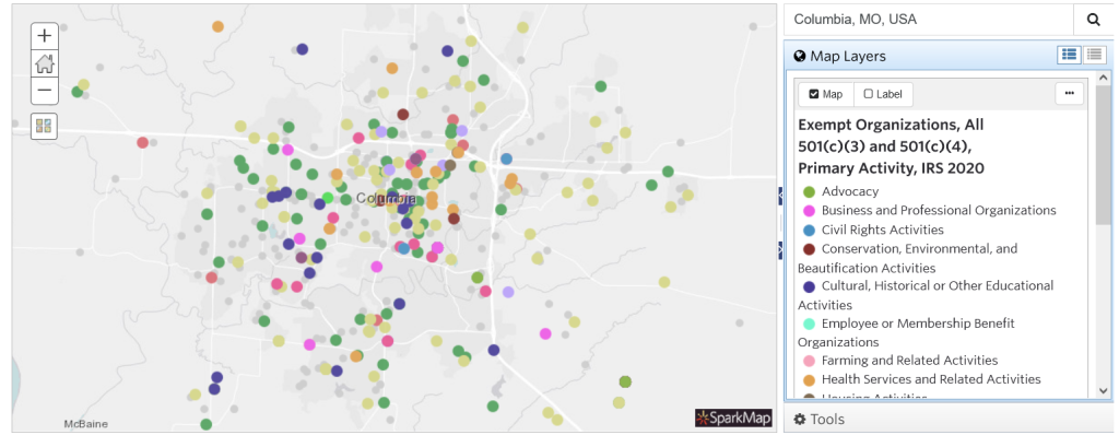
Let’s select the Exempt Organizations, All 501(c)(3) and 501(c)(4), IRS 2020 layer and click “Add to Map“. For those of you playing along at home, here’s a link with that layer already loaded: https://cares.page.link/kDYb

Once we’ve added our layer to the map, let’s zoom into our desired location. You can zoom in using the controls on the map itself, or use the Location box just to the right of the map.
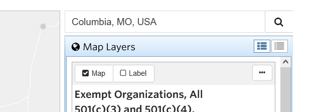
Ta-da! Our map of 501(c)(3) and 501(c)(4) nonprofits centered on Columbia, MO:
Use Select Query Tool to find Nonprofits
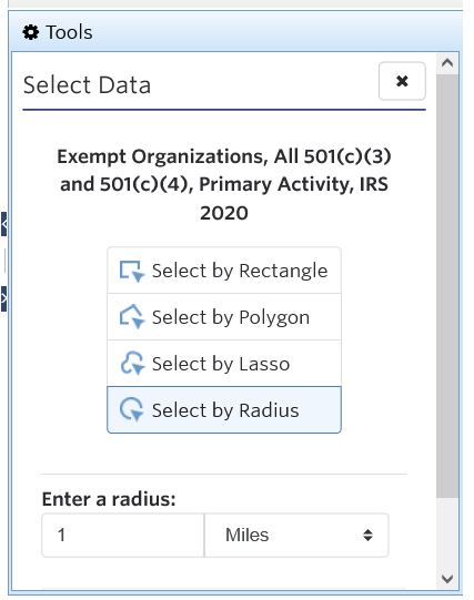
Now the fun begins. We’re going to use the Select Data tool to discover all the 501(c)(3) and 501(c)(4)s within 1 mile of a specific point on the map.
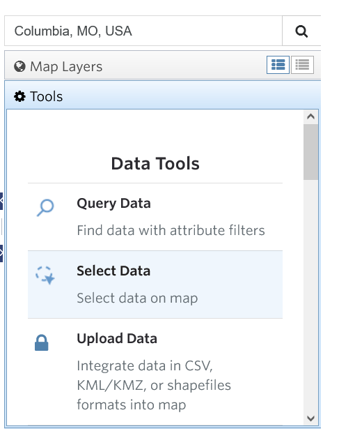
- Go to the Select Data tool. (Tools -> Select Data).
- Click ‘Select By Radius’. You can also select by Rectangle, Polygon or Lasso, if those shapes better define your area of interest. We’ll enter a radius of 1 mile.
- Click on the map to center your circle, aaaaand:
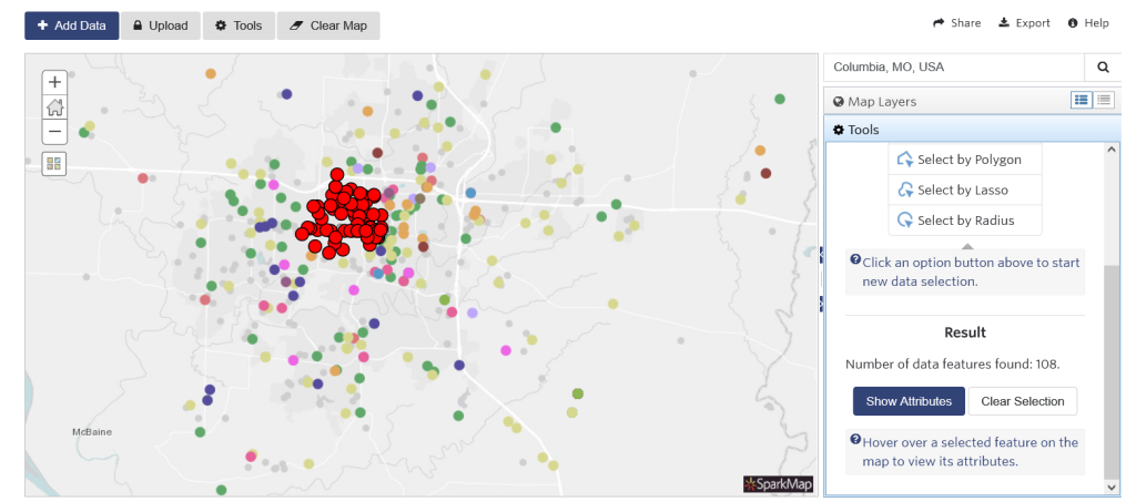
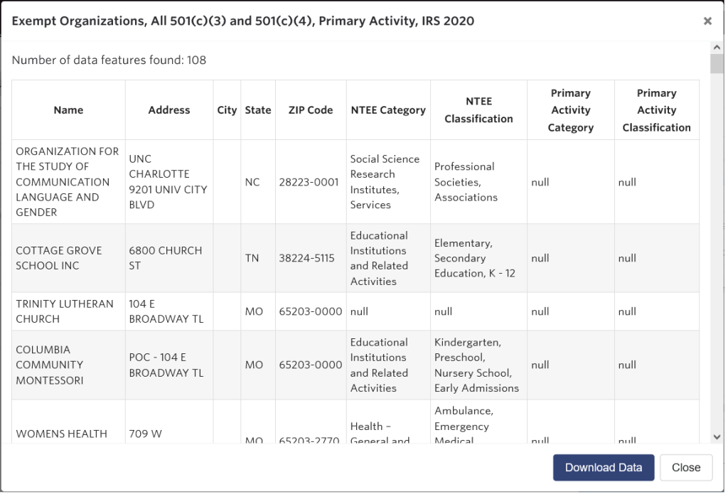
- BOOM. Our subset of nonprofits appear highlighted in red. Hover over any to show its attributes.
- To see and download data for this subset, click “Show Attributes”:
What’s next?
We’ve successfully located our local nonprofits in an area of interest using the Select Data tool in the Map Room. Now try it with data and a location that is meaningful to your community work. Any data layers with point data work well with this tool, including:
- SNAP Authorized Retailers, USDA (starter map)
- Providers of Service, US DHHS (starter map)
- All Public Schools, NCES CCD (starter map)
For a deeper look into the Select Data tool and other tools, check out How to Use the Select Data Tool and more in our Support documentation.
Whatever causes you support this year, we hope you find the end of 2021 to be fulfilling!